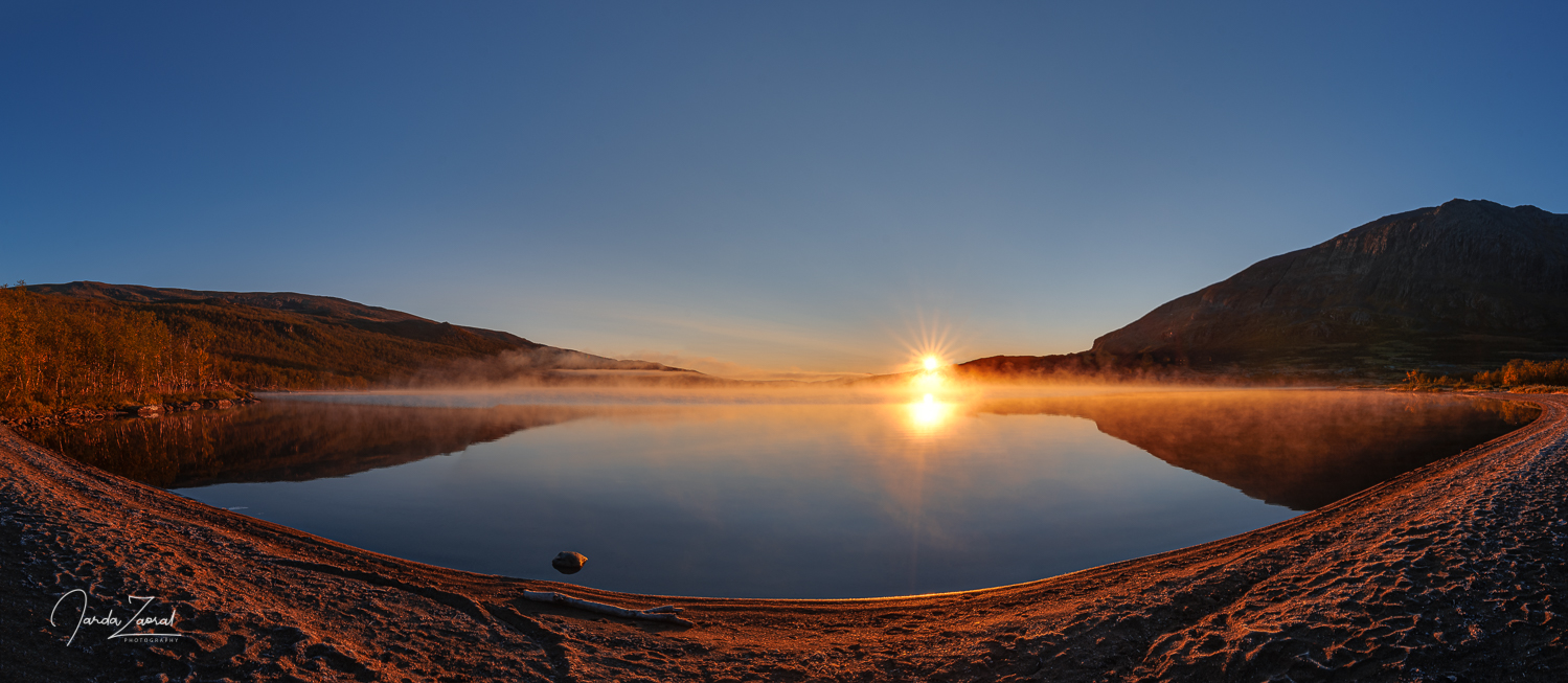
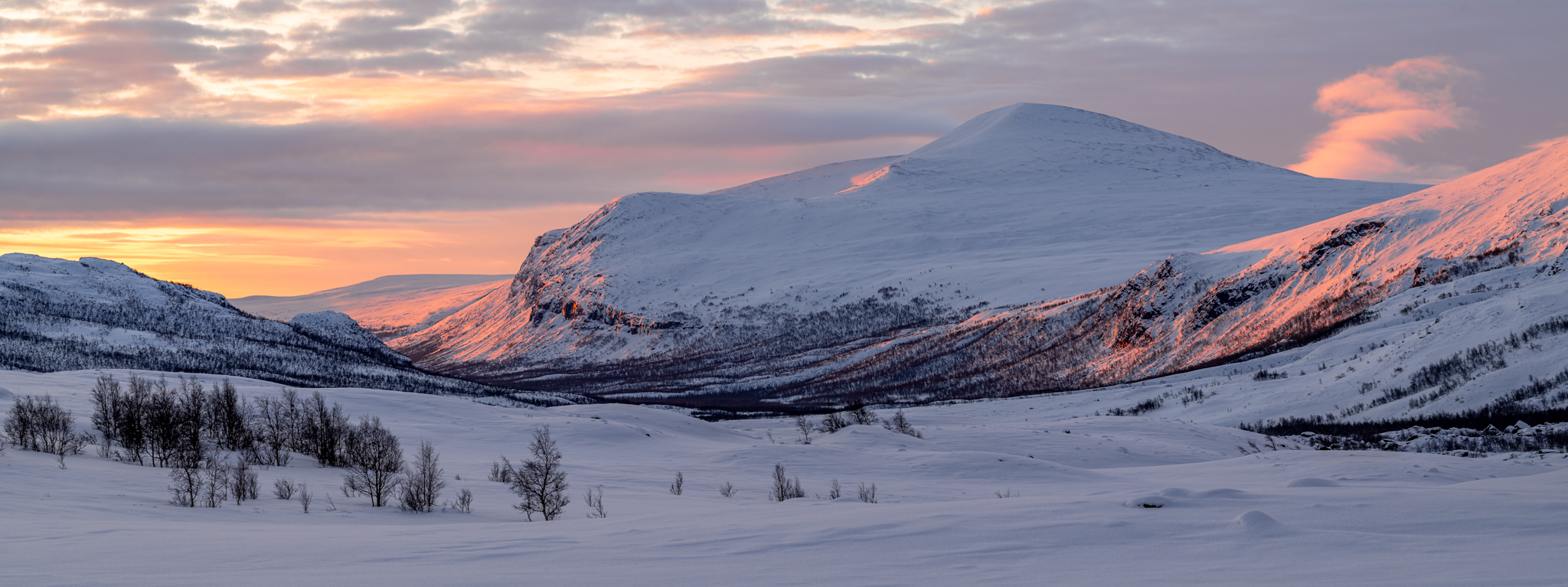
Do you know where you can experience one of Europe’s last true wildernesses? If you haven’t heard of the mythical Kungsleden (translated as the King’s Trail) in northern Sweden, read carefully. It’s a 470km-long trail from Hemavan to Abisko that leads through a beautiful unspoilt mountain landscape full of vast lakes, high mountains and deep valleys. The trail is very popular in summer, but the you can experience the greatest adventure on Kungsleden in winter. My friend and I decided to explore the most interesting part of the trail, the 107km journey from Abisko along Sweden’s highest mountain, Kebnekaise, to Nikkaluokta to see what this winter adventure entails.
How to get to Kungsleden?
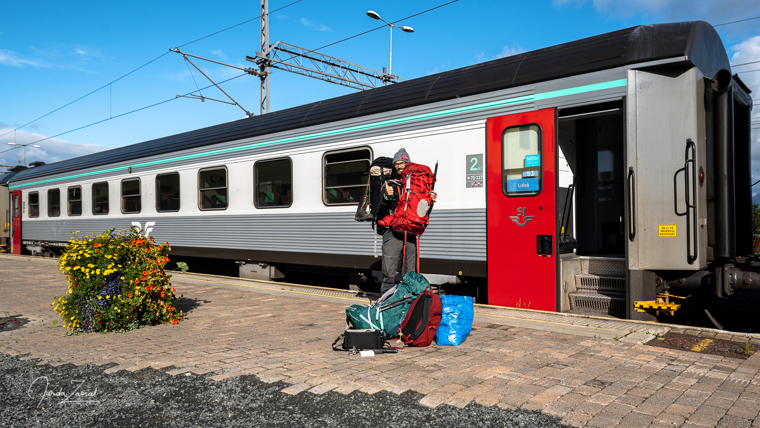
Most visitors of Kungsleden start their journey in Abisko. The most convenient way to get there is to fly to Stockholm Arlanda and to take a direct overnight train right at the airport train station, which will take you to the starting point at the Abisko Turiststation stop. You will very likely meet other winter enthusiasts in the train and spend valuable time talking about upcoming adventure with them. The train offers comfortable beds so you can rest well before you wake up right at the start of the adventure.
Another and slightly quicker option is to fly to Kiruna, Sweden, with a change of planes in Stockholm, and from there you can take a bus and train to Abisko. However, I don’t recommend this option if you have a lot of equipment with you. Because of the multiple transfers, this option is less convenient.
The way back depends on where you finish your journey on Kungsleden. In our case, we ended up in Nikkaluokta, from where we took a bus to the station in Kiruna, and from there we took again overnight train to the airport in Stockholm.
Where to sleep on Kungsleden in winter?
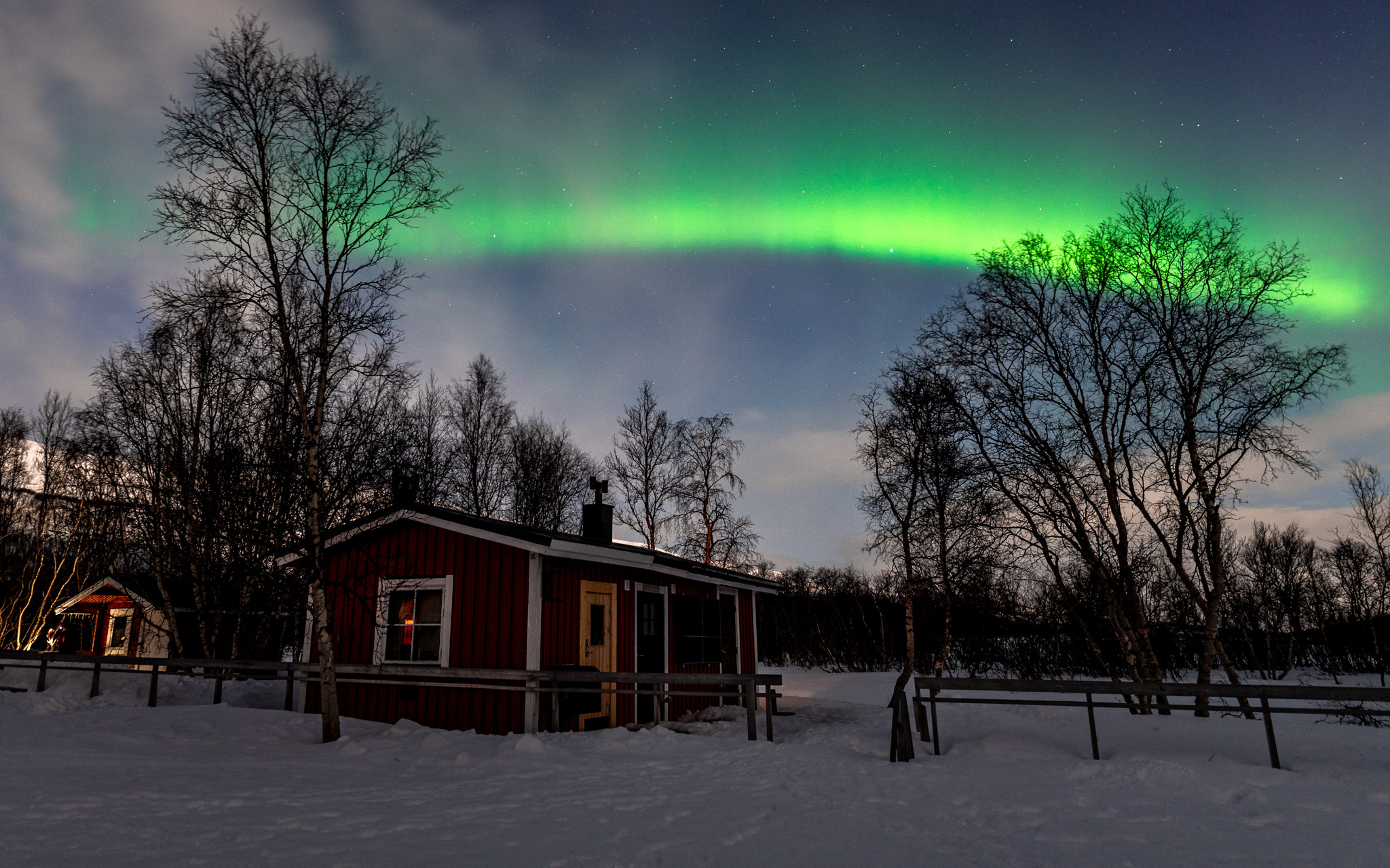
In winter, 99% of visitors stay overnight in local Sami villages, which can be found every 10 to 20 km along the way. You can find a complete list of them on the Swedish Tourist Association’s (STF) website. These villages offer cosy accommodation that is usually simple but functional. For a fee of 500 SEK (in 2024 if you are a member of the STF) you get everything you need in this inhospitable and frozen landscape. If you’re planning on staying inside, it’s definitely recommended to become an STF member before your trip, as you’ll get significant discounts at all the huts along the way. The huts offer all the essentials you need during your winter adventure:
- Sleeping rooms: Huts offer shared sleeping rooms, usually in the form of dormitories. They are equipped by mattresses, duvets and pillows, but you have to bring your own bedding. I recommend a lightweight summer sleeping bag to ensure warmth and comfort.
- Kitchen facilities: Basic cooking equipment such as cookers, pots, pans and utensils are available in the cottages so tourists can bring their own food and prepare it there.
- Drinking water supply: The cottages have drinking water sources that visitors can use for drinking and cooking. However, water must be brought from a water source that may be up to a kilometre away. Housekeepers will show you how to get the water. It’s an exciting activity and it will be one of your favourite adventures on the trip.
- Shop: Huts sell a basic range of food. Check the Swedish Tourist Board STF website in advance for current offer.
- Limited electricity and lighting: Be ready that there is no electricity in the cottages. You can charge your batteries only with your own powerbanks which are necessary for this trip. In the evening kerosene lamps and candles are used as sources of light.
- Information: Some lodges have satellite internet access so visitors can get additional weather information, which is often crucial for planning the following days.
- Toilets and sanitary facilities: There are dry toilets at the villages and saunas are used for washing. Before entering the sauna, you can wash yourself with warm water from in barrels.
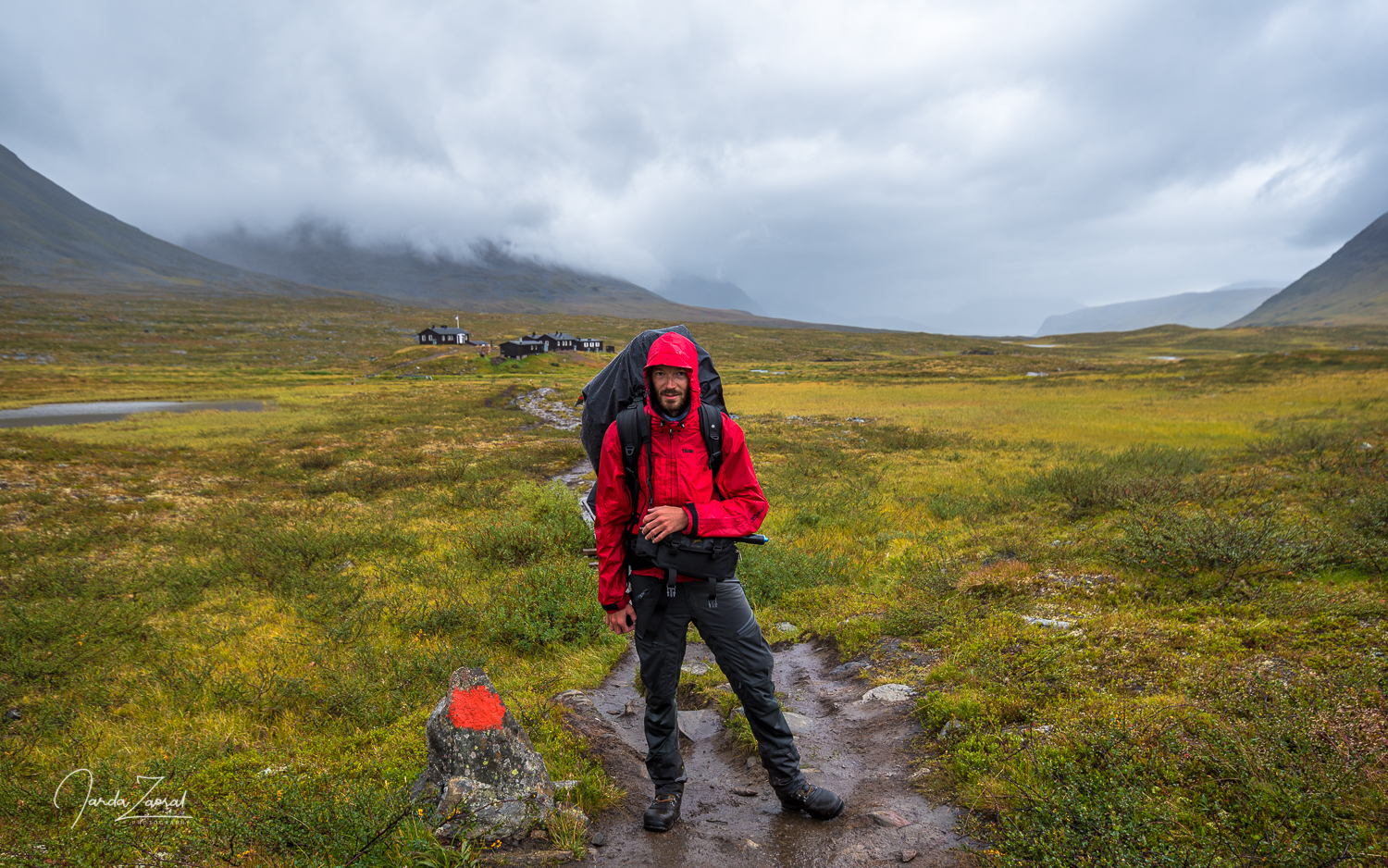
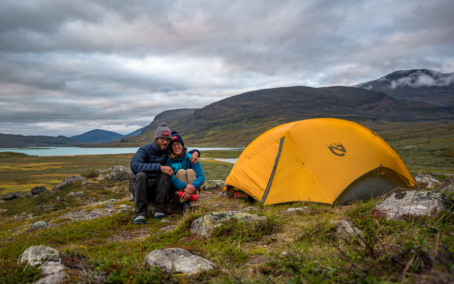
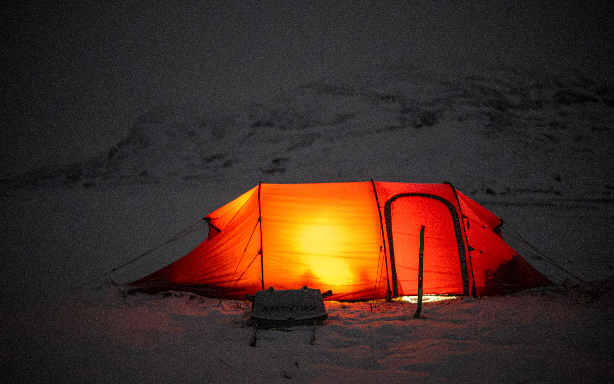
TIP FOR PEOPLE WHO PLAN TO SLEEP IN A TENT: You can also use the cabins even if you don’t want to stay overnight. For a fee of SEK 200 (year 2024) you can sleep in a tent next to the vilalges and use all the services listed above. This makes it a great alternative for adventurers who decide to go on Kungsleden with their own tent and sledge. This was also our case, and we were only going to use the huts for overnight stays in case of emergency or bad weather.
It worked out very well. In the end we managed to stay all nights outside but we sometimes took advantage of the facilities of local huts. They were very comfortable and cosy. It was very nice to warm up for a while and to make delicious food inside.
What is the best route for Kungsleden in winter?
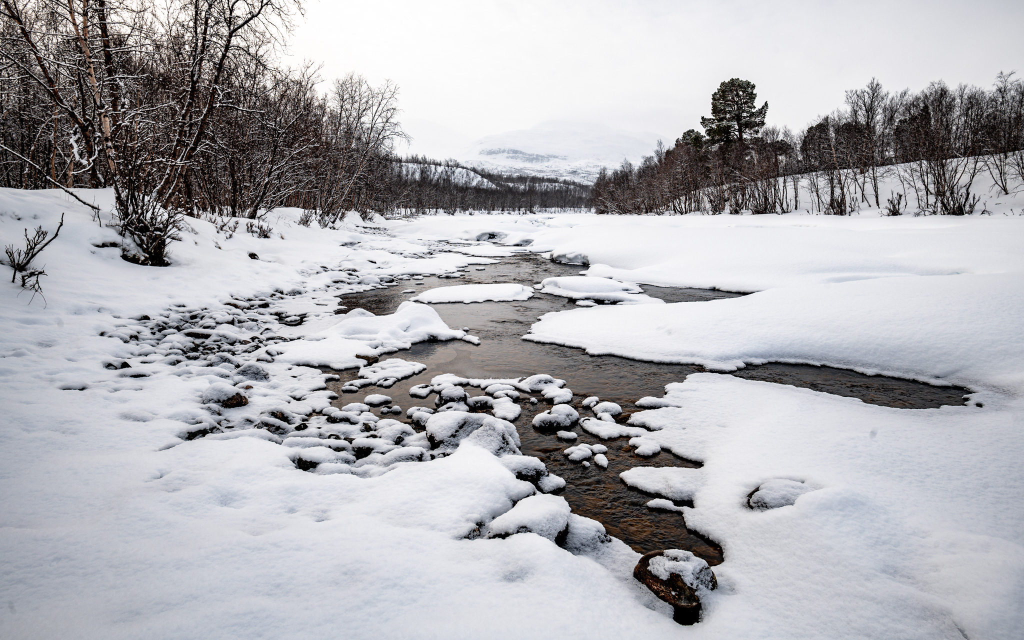
In winter, the route is a some kilometres shorter than in summer, because lakes on Kungsleden are all covered with ice and snow. This is a nice advantage compared to summer but as you have to carry more equipment, the journey is much more demanding and therefore slower than in summer. We wanted to try the most popular and most beautiful part of Kungsleden so we set out for a trip from Abisko to Nikkaluokta. This is the most common itinerary:
- Day 1: From Abisko to Abiskojaure: The first day is a warm-up. You will only have 13km to go with a gentle climb of around 100 elevation meters.
- Day 2: From Abiskojaure to Alesjaure: The second day is the most challenging of the entire journey to Nikkaluokta. You have to prepare for a 20km long trip and 400 elevation meters.
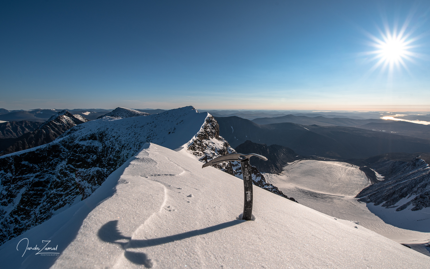
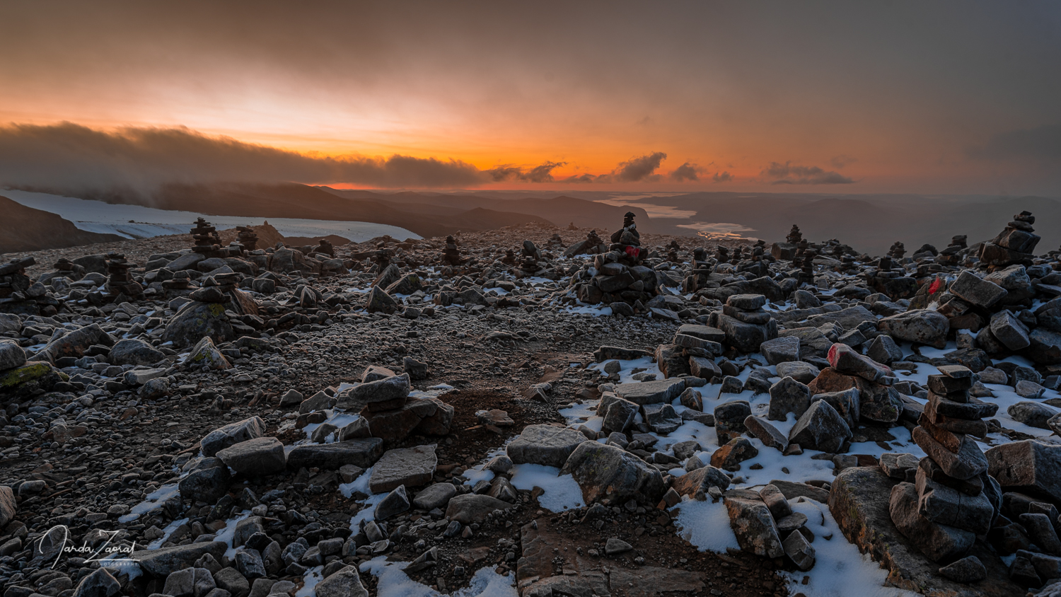
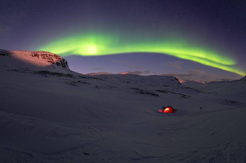
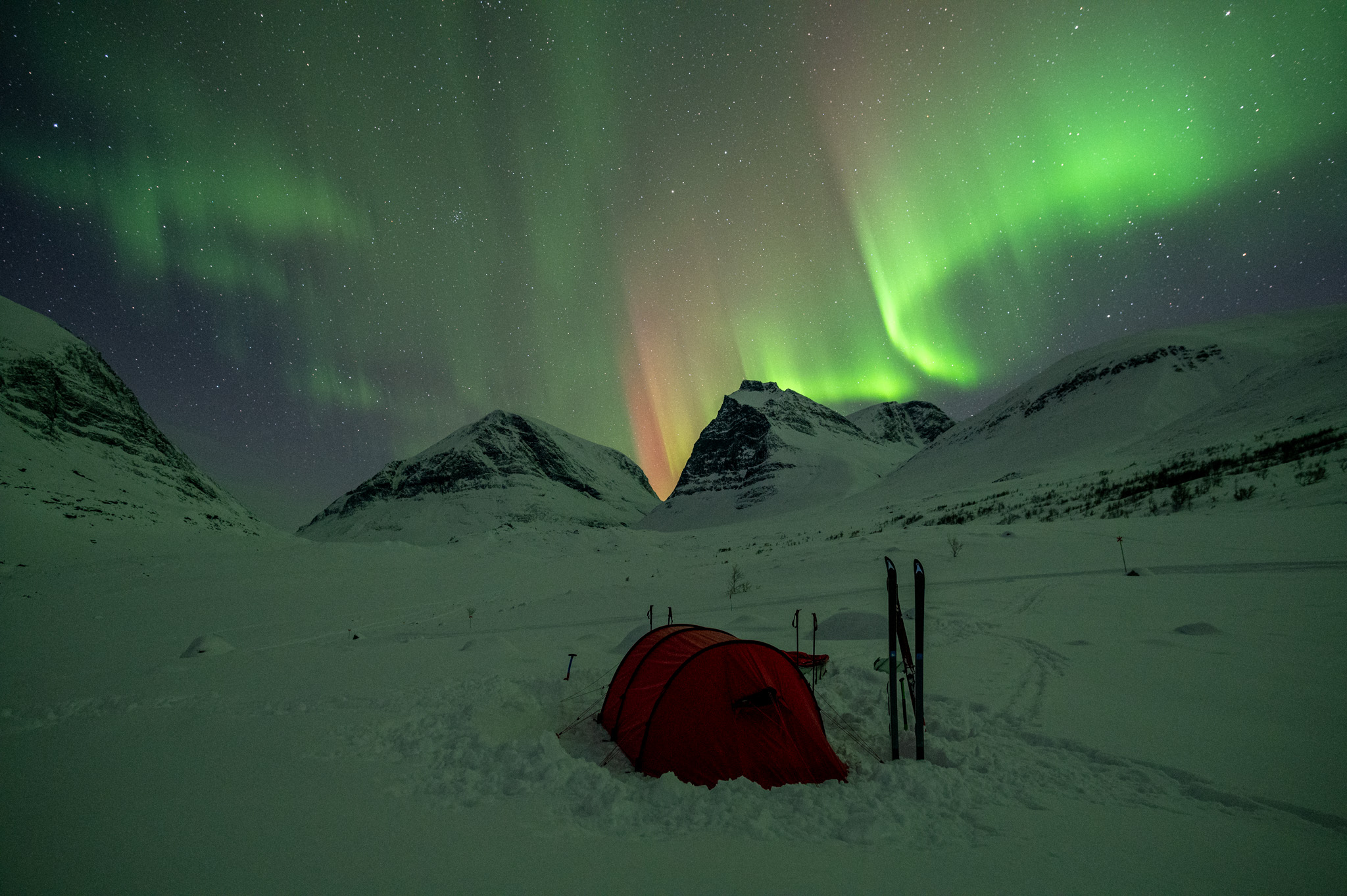
- Day 3: From Alesjaure to Tjäktja hut: The third critical day is fortunately not that long. However, you have to prepare for a steeper climb of 300 elevation meters at the end. Look forward to this day because Tjäktja hut offers fantastic views and perfect view to the north so you have an amazing chance to see northern lights from here.
- Day 4: From Tjäktja to Sälka: Not far from the Tjäktja hut, you will reach the highest point of the whole trip – the Tjäktja Pass. Here you will be exactly halfway on the way from Abisko to Nikkaluokta. At the pass you can rest in an emergency shelter before the biggest descent of the whole trip. This is the only place of the whole trip where the descent is steep, so be careful when descending this 2km downhill. The whole route from Tjäktja to Sälka is 13km long and you will climb 150m right at the start and then you can look forward to descending 350m.
- Day 5: From Sälka to Singi: The shortest day is only 12km long, with 80m of elevation gain and 190m of descent. It is the easiest day of the whole trip so you can take it easy and take a longer relax in the beautiful valley where Singi lies. It’s good to have one short day in the itinerary because this day also serves as a reserve day in case it isn’t possible to move on any of the previous days due to tough weather conditions. Yes, it sometimes happens due to a storm. It can happen that you have to stay the whole day in a hut and then make a longer stretch and manage a trip from Tjäktja to Singi for instance.
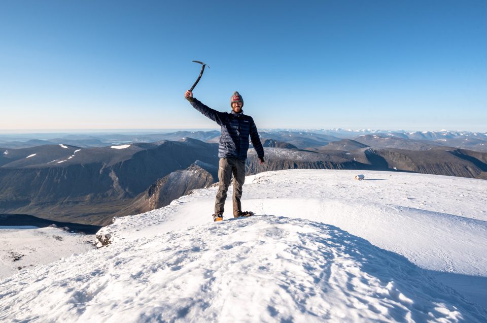
- Day 6: From Singi to Kebnekaise fjällstation: This 15km long route leads over a pass with a beautiful view and then through a deep valley to the foot of Sweden’s highest mountain, Kebnekaise. This is my favourite day of the whole journey as it offers fantastic views over the Kebnekaise massif.
- Day 7: From Kebnekaise Fjällstation to Nikkaluokta: The last day is very long, ca 20km and probably the least interesting. That’s why most tourists decide to shorten this route and pass it on snowmobiles to catch a bus from Nikkalookakta to Kiruna, which awkwardly runs only once a day at 12:00 sharp.
You can see from the route description above that the whole route is mostly flat or with just a small up/downhill. However, if you carry a lot of equipment, you will feel the 300 metres of altitude in your body. We definitely did!
If you’re planning to travel with a tent, you have a slight advantage. You are much more flexible and can adjust your daily mileage depending on how you feel. In fact, you are allowed to camp anywhere in Sweden as long as you set a tent at least 150m from a household. The only exception is national parks so be careful with planning your first two days. During these you will be hiking in Abisko National Park and you are only allowed to camp in designated areas, namely right next to the Abisko STF hut, in Abiskojaure and at a designated camping site called Nissonjokk. Nissonjokk is the only place out of these three where you don’t have to pay for the tenting spot (in Abisko and in Abiskojaure, it costs 200 SEK to tent and you can use the facilities).
When is the best time to visit Kungsleden in winter?
Compared to the the rest of Europe, the winter season in northern Sweden starts much later. This is due to the short days in December and January and the extreme cold weather. In 2024, the local huts were open between 16/2 and 21/4. Which date to choose? My recommendation is the end of March.
At the end of March temperatures tend to be more comfortable than in the second half of February or during early March and days are already long enough to manage your daily trips. The end of March is also great when it comes to the chance of seeing the Northern Lights. On the contrary, April nights are already short so there is smaller chance of seeing the Northern Lights and you don’t want to miss them. It’s one of the biggest attractions of a every Kungsleden trip. If you want to know more about northern lights, chack out my article Practical Guide to see Northern Lights.
Weather on Kungsleden in Winter
In winter, the weather on Kungsleden can be very harsh and unpredictable, which is why this route requires thorough preparation and proper equipment. Be prepared for very low temperatures. In winter, temperatures on the Kungsleden can be well below freezing. Temperatures below -10°C or even -20°C are not at all unusual.
However, the low temperatures aren’t the biggest challenge on Kungsleden. Severe cold weather is manageable. Do you know what is important to be careful about? Strong winds and gales. They are very frequent on Kungsleden and they dramatically reduce the “feels like” temperature.
Another thing to watch out for is avalanches. Heavy snowfall and wind can also cause avalanche danger. Most of the King’s Trail is off avalanche terrain, but be sure to check with local huts for current avalanche conditions.
It might sound like I would like to scare you off coming to Kungsleden in this paragraph but I didn’t mean it. There are also beautiful sunny days on Kungsleden during which you can enjoy views of the amazing Scandinavian landscapse. Be ready also for this weather and don’t forget a sun cream and proper sunglasses.
To summarise the weather on Kungsleden, you need be prepared for both sunny weather and extreme cold conditions. The weather can change quickly on Kungsleden, so be prepared for variable conditions. Check the weather at each station before your every day adventure and be prepared for anything.
What is better? Snowshoes or skis on King’s Trail in winter?
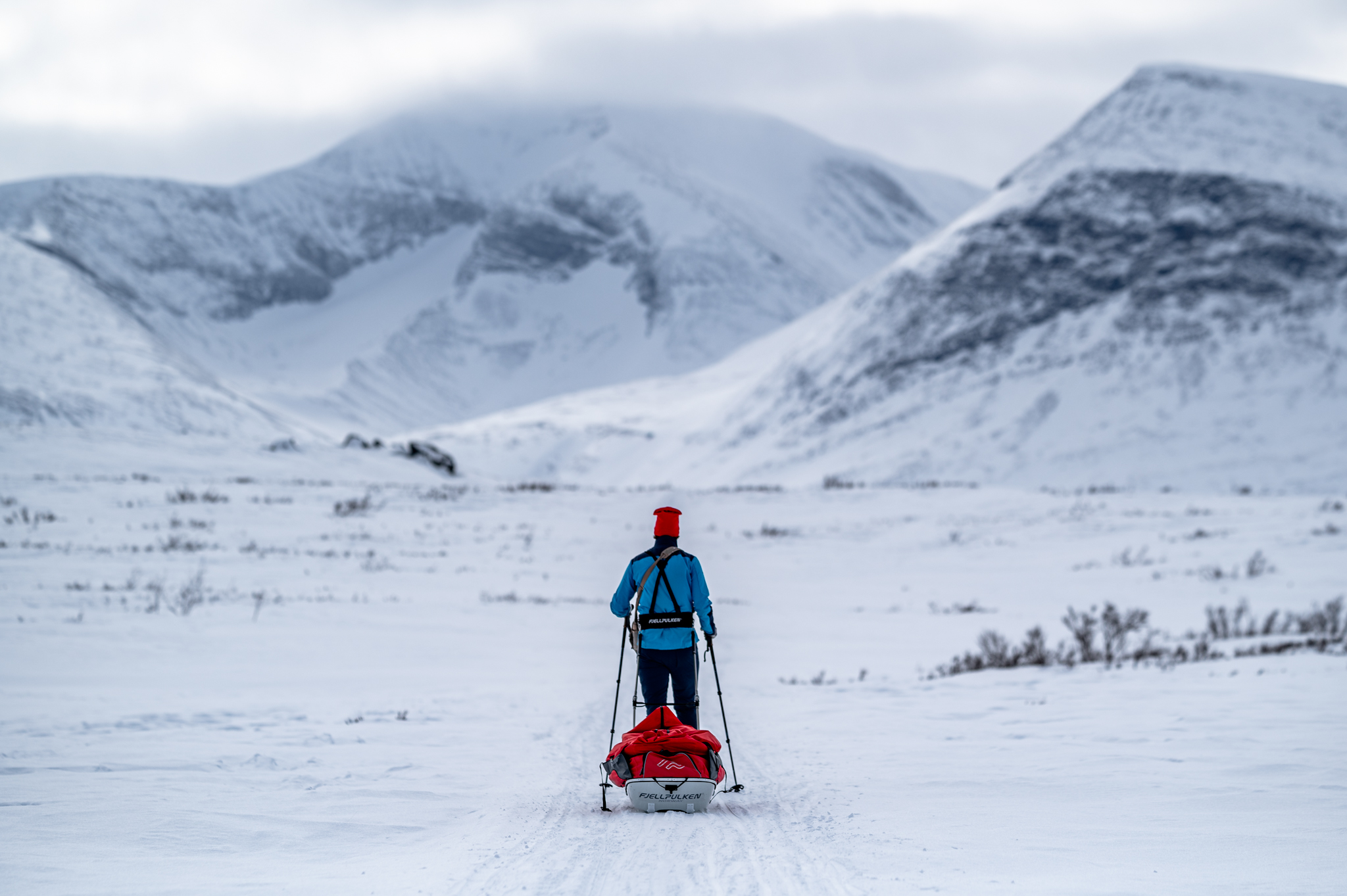
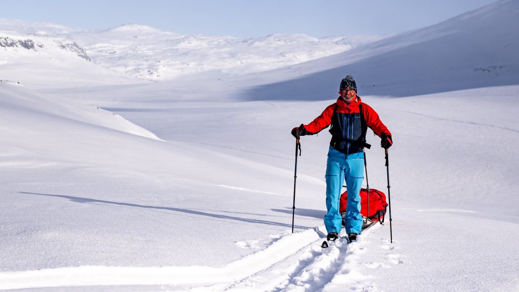
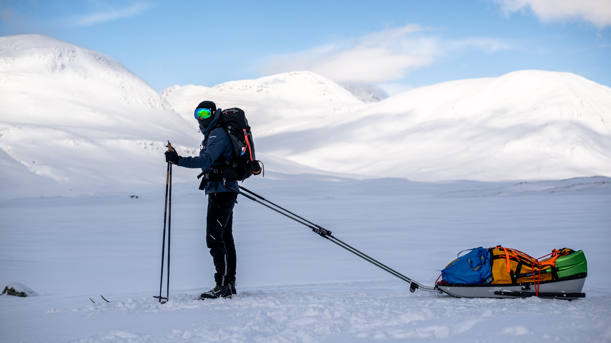
As you proably guess, there is a lot of snow on Kungsleden in winter, so it isn’t possible to set out on such adventure in common hiking shoes. Instead, you need to consider whether to bring snowshoes or skis. My girlfriend and I tested part of the Kungsleden on snowshoes in the past and it wasn’t a bad choice. However, we were in the vast minority using snowshoes and we were much slower than skirs. In fact, only foreign visitors use snowshoes.
This time we tested Kungsleden on skis as 99% of locals and we quickly understood know locals don’t use snowshoes. Skis are much faster and comfortable and you can also enjoy the downhills. Snowshoes are better in very steep terrains but it isn’t the case of Kungsleden. You don’t have to worry about challenging up/downhills here. Most of the trail is flat and you’ll only have to pass gentle ascents and descents.
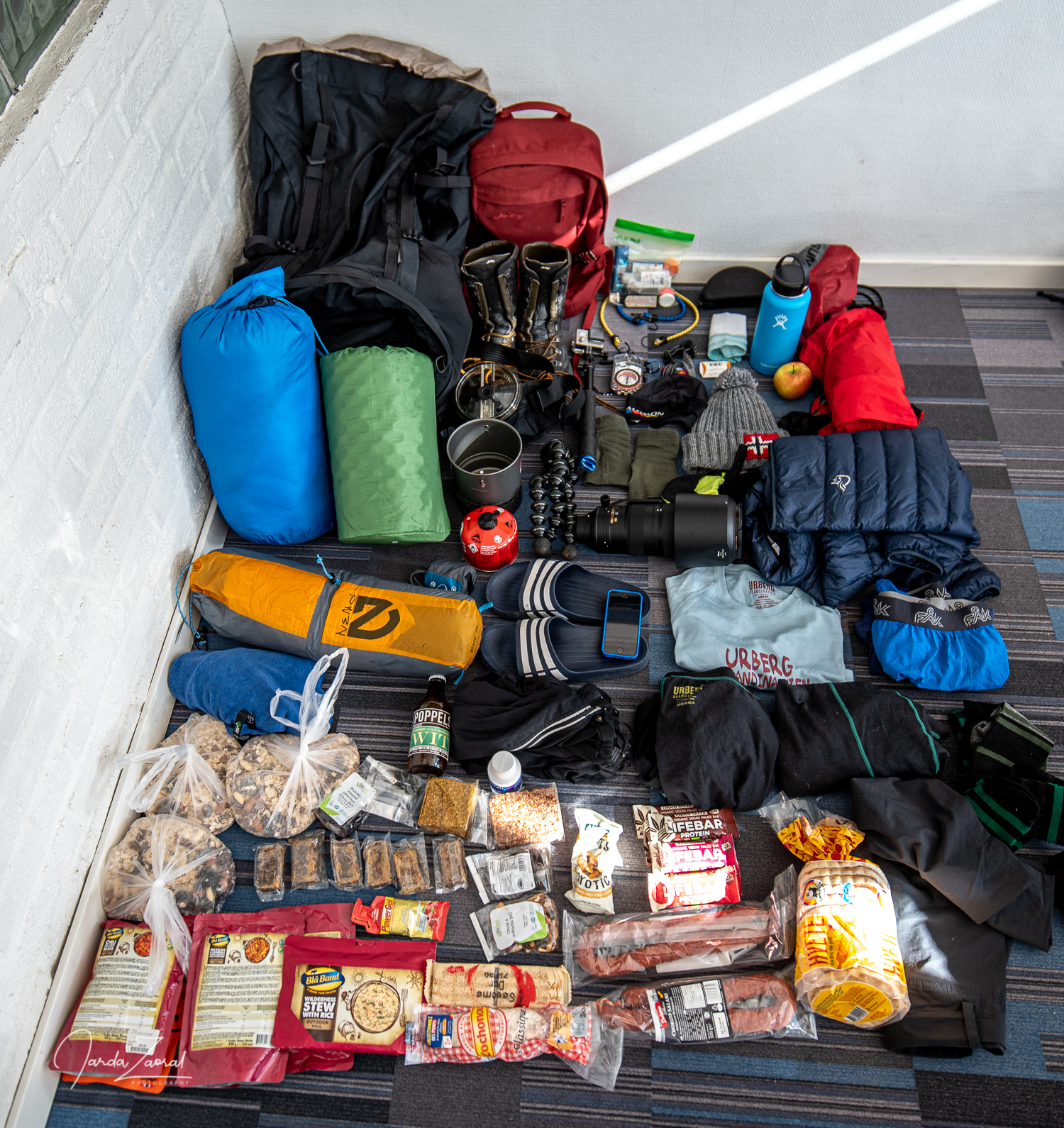
Equipment on winter King’s Trail
For a winter expedition beyond the Arctic Circle, proper equipment is necessary. To enjoy Kungsleden and to feel comfortable, it’s necessary to have especially warm clothing. My recommendation is to have several layers ready and you adjust these according to the current temperature. We had moments on our trip when it was sunny and windless with temperatures just below freezing. During these times we were ascending in just T-shirts. On the other hand, we experienced conditions with strong headwinds the following day, when the temperature also dropped by twenty degrees. In such conditions I used two down jackets and several layers underneath. I know I repeat myself but be ready for various weather conditions.
Best experiences and secret tips for winter Kungsleden
Since we wanted to experience winter Kungsleden with carrying our own tent and sleeping outside in the wilderness, we definitely didn’t have shortage of experiences. Here are the ones which we will never forget and wish you could experience too:
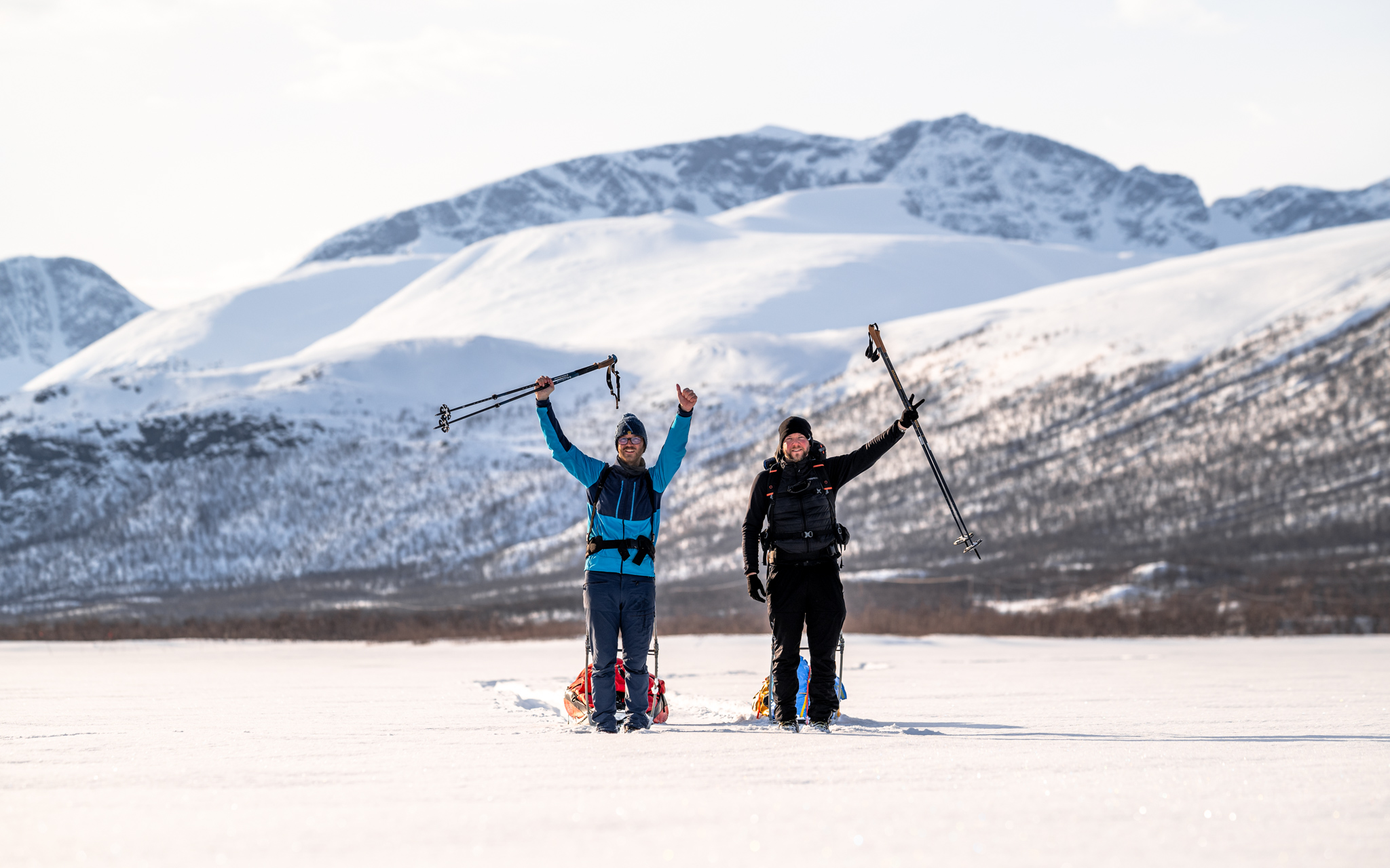
- 107km and 107kg: There is a scale at the starting point at the STF hut in Abisko where both summer and winter hikers/skiers weigh their backpacks or other luggage before setting off. My friend and I measured 107kg. A fateful number! That’s exactly how many kilometres we were going to cover on the trip to Nikkaluokta. Will we manage to carry over 50km on every sledge? Fortunately, we could say at the end of Kungsleden: Yes! Thanks to the sledge that glides smoothly over the snow, it isn’t as tough as it may seem! If you plan to bring a lot of gear, definitely rent a sled at Abisko STF hut. But beware of necessary reservations! you have to book a sledges a long time in advance. In 2024, the sledges were already booked six months in advance.
- Aurora Borealis: We were lucky and managed to see Northern Lights every other day. It’s indescribable beauty. To see a strong aurora, I summarize all necessary tips in this article.
- Sauna: The saunas are definitely the most pleasant bonus of the local cottages. You will never forget jumping into a frozen lake or into the snow in -20 degrees after a few minutes in a hot sauna. Just beware that not all of the huts offer sauna experience. You will find a sauna in all the huts except Tjäktja and Singi.
- Extreme conditions in Tjäktja Pass: Timing of the strong winds couldn’t be worse on our journey. The windiest day was forecast for the highest point of the journey in the Tjäktja Pass. We had to get up at 4am to avoid the strongest winds, which were expected around noon. How it paid off! We had harsh conditions anyway as we were hit by such strong winds that icicles were being formed in our beards. But we managed to conquere the Tjäktja pass. Be sure to watch the forecast ahead and adjust your wake-up call accordingly to avoid the strongest winds. Some other expeditions didn’t obey the forecast and didn’t make it via Tjäktja pass and had to stay one more day at Tjäktja.
- Photography: if you are a keen photographer, you will love winter Kungsleden. There is wonderful scenery every day and it’s fascinating to photograph the changeable weather. But don’t forget to bring spare batteries and power banks. Unfortunately, there is no place on the way where you can charge your batteries. You can charge everything up as soon as you reach Kebnekaise fjällstation.
Book a guided tour from Abisko to Nikkaluokta
Would you like to experience Kungsleden in winter and don’t have enough experience? I’m planning to organize a guided tour from Abisko to Nikkaluokta next year at the end of March! We will be doing the trip on skis with overnight stays in all the huts on the way. Are you interested? Drop me an email at info@jardazaoral.com and I’ll come back to you with more information.